Hawaii boasts a unique and diverse climate due to its specific latitude. Situated between 19 and 23 degrees north of the equator, the Hawaiian islands experience a remarkable range of climatic conditions across various islands.
The latitude of Hawaii plays a crucial role in shaping its climate, resulting in a year-round warm and inviting atmosphere.
In this article, we’ll explore how Hawaii’s precise coordinates contribute to its unique and inviting climate, making it a dream destination for beach lovers and nature enthusiasts alike.
What Even Is Latitude + Longitude?
Latitude and longitude are parameters or coordinates that help determine the location of any place on Earth.
Latitude is a term used to describe a location’s position on the Earth’s surface in relation to the Equator.
- Latitude lines are imaginary lines that divide the Earth. They run east to west, but measure your distance north or south of the earth’s equator. Because of this, the equator is the most well-known latitude line, as most people generally know where it lies on our Earth.
- At 0 degrees latitude, it equally divides the Earth into the Northern and Southern hemispheres. From the equator, latitude increases as you travel north or south, reaching 90 degrees at each pole. Each degree of latitude covers about 111 kilometers on the Earth’s surface.
Longitude is the other variant we use with latitude to work out where exactly something is located on our globe.
- Lines of longitude, also called meridians, are imaginary lines that divide the Earth. They run north to south from pole to pole, but they measure the distance east or west. Since the Earth is almost spherical in shape, it has 360 degrees and is, therefore, divided into 360 longitudes.
- The prime meridian, which runs through Greenwich, England, has a longitude of 0 degrees. It divides the Earth into the eastern and western hemispheres.
So now that we know what latitude and longitude are, we can work out what Hawaii is.
Hawaii’s Latitude
Hawaii has a latitude of 19.8968° N and a longitude of 155.5828° W which means it lies in the Oceanic Region of the Pacific Ocean. Hawaii is the only state in the U.S. to exist as far west of North America as it does.
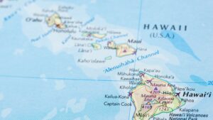
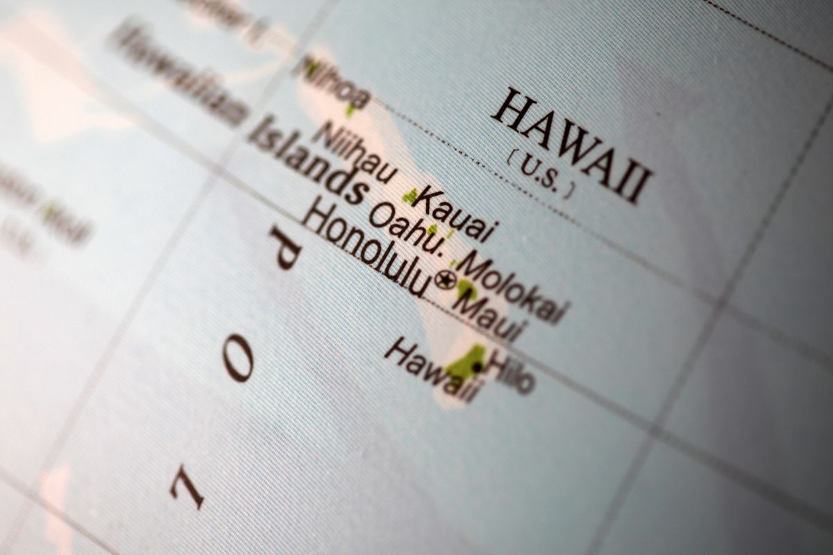
Hawaii is made up of eight main islands, which are spread out over 1,500 miles. The islands are easy to locate on a map, as they are the only landmasses in the middle of the Pacific Ocean. Hawaii’s latitude is also clearly visible on a map, as it is located close to the Equator and is crossed by the Tropic of Cancer.
Here’s a list of the different islands’ latitudes and longitudes, along with those of their largest cities:
| Island | Latitude | Longitude | Largest City | Latitude | Longitude |
|---|---|---|---|---|---|
| Hawaii | 19.542915 | -155.665857 | Hilo | 19.707094 | -155.086935 |
| Kailua-Kona | 19.639994 | -155.996926 | |||
| Maui | 20.798363 | -156.331924 | Kahului | 20.889335 | -156.472946 |
| Oahu | 21.438912 | -158.000057 | Honolulu | 21.306944 | -157.858333 |
| Kauai | 22.096439 | -159.526123 | Lihue | 21.98139 | -159.371109 |
| Lanai | 20.8294 | -156.9205 | Lanai City | 20.8282 | -156.9152 |
| Molokai | 21.1325 | -157.2636 | Kaunakakai | 21.0889 | -157.1978 |
| Kahoolawe | 20.5729 | -156.6308 | |||
| Niihau | 21.8959 | -160.1567 |
Impact of Hawaii’s Latitude on Climate
Hawaii’s latitude has a significant impact on its climate. The islands experience a tropical climate, which means they have warm temperatures throughout the year, with a high level of humidity. The position of the islands also affects the direction and strength of the trade winds that blow across the Pacific Ocean, influencing the weather patterns and precipitation.
Hawaii’s latitude and position on the Earth’s axis have a significant impact on its weather and climate. The islands have a tropical climate, with temperatures averaging between 75 and 85 degrees Fahrenheit throughout the year. Hawaii’s location also makes it vulnerable to tropical storms and hurricanes during the rainy season, which lasts from November to March.
Similar Latitudes of Other Tropical Destinations
So now that we know the latitude and longitudes of some of the Hawaiian Islands we can look at the coordinates of other tropical destinations that are similar to those of Hawaii.
| Destination | Country | Latitude | Longitude |
|---|---|---|---|
| Cancun | Mexico | 21.161908 | -86.851527 |
| Tulum | Mexico | 20.211029 | -87.465350 |
| Mexico City | Mexico | 19.4326 | -99.1332 |
| Havana | Cuba | 23.113592 | -82.366592 |
| Dhaka | Bangladesh | 23.810332 | 90.412518 |
| Hong Kong | China | 22.319303 | 114.169361 |
| Sahara Desert | Africa | 23.4162 | 13.2131 |
| Mauritius | Mauritius | -20.348404 | 57.552152 |
| Marrakech | Morocco | 31.625965 | -7.989099 |
| Mecca | Saudi Arabia | 21.3891 | 39.8579 |
Considering how many of these locations are on the other sides of the world, it’s interesting to see how close they are to Hawaii on the latitude.
This means that they’re either directly east or west of Hawaii, and they’ll experience somewhat similar climates, we can see that Hong Kong, Mecca, and Mexico City would all share very similar temperatures, and the only real exception to this is the Sahara, and that’s just because it’s a desert.
They’ll all share the same day length too. This is because they’re on nearly the same curve that the earth follows, which means that our day and night cycle is synced up, and the heat will be more or less the same.
Because Hawaii is a state that’s made up of islands, temperatures can fluctuate, and be more unpredictable than a few other major cities or locations in our list, but because of the state’s closeness to the equator, you’ll always see the heat in the aloha state.
Hawaii As An Isolated Location
Hawaii as a state is quite isolated from the rest of the world, in fact, it’s the most isolated populated landmass in the entire world, being 390 miles from California and 3,850 miles from Japan, it’s safe to say that there’s nothing really near Hawaii other than ocean for a long, long way.
As many people know, Hawaii formed from the Hawaiian-Emperor seamount chain, which is why there’s so much volcanic activity on the islands, and it’s getting bigger and bigger.
Obviously, it’ll take thousands of years to see any real change, but this is why it’s even more important to work out Hawaii’s latitude and longitude, as it’s so far from everywhere else in the world.
Final Thoughts
In conclusion, Hawaii’s latitude is a critical factor that affects its climate, weather, and overall geography. Its location close to the Equator makes it a tropical paradise, with warm temperatures and beautiful scenery. Understanding Hawaii’s latitude and position on the Earth’s axis is crucial for visitors and residents alike, as it helps to prepare for the weather and enjoy all that the islands have to offer.
 Are There Cicadas In Hawaii?